What is ClimateCheck®?

ClimateCheck®

RPR has partnered with ClimateCheck® to offer a resource that determines a property’s future risk of climate change-related hazards. ClimateCheck® rates a property’s future risk of climate change-related hazards and assigns a rating from 1 to 100, with 100 representing the highest risk. By future, they mean the year 2050 — a period within the lifespan of a 30-year mortgage signed today.

Property Details

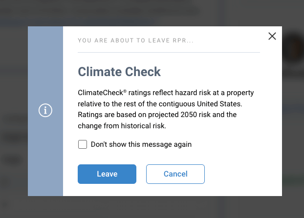
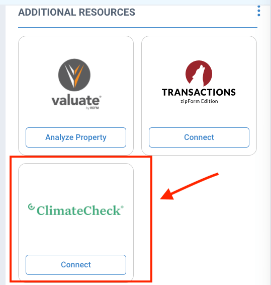
The ClimateCheck® link is located in the “Additional Resources” section of any Property Details page. Click the Connect button, then select Leave in the pop-up box, to acknowledge that you are opening the ClimateCheck website in a new browser tab. 
Climate Risk Snapshot

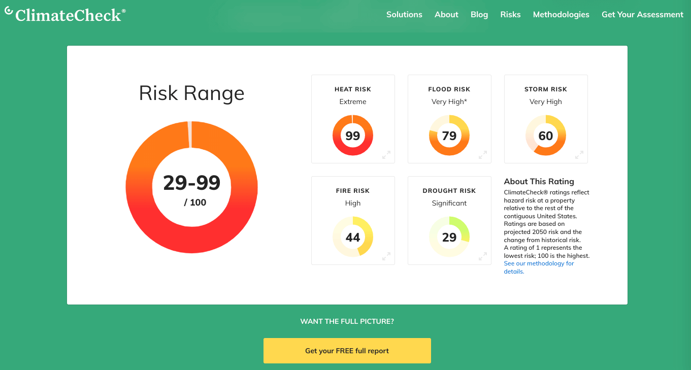
Ratings are displayed in a snapshot of the five hazards rated; Heat, Flood, Storm, Drought, and Fire. Each hazard is assigned a rating from 1 to 100, with 100 representing the highest risk.

ClimateCheck® offers a free report on their website that you can email or print to share with your clients. The report contains ideas that the property owner can do to improve the property and prepare against the risks. Select the button under the snapshot to have a report emailed to you within minutes. 
Risk Range

The Risk Range is simply the lowest rating of the five hazards and the highest rating of the five hazards. 
Risk Rating Information

ClimateCheck® rates a property’s future risk of climate change-related hazards and assigns a rating from 1 to 100, with 100 representing the highest risk.

Click on the links below for more information

Heat risk is based on the typical number of extremely hot days that you can expect in the future. An extremely hot day for your area has a high temperature that normally happens only on the hottest 8 days of the year, during the baseline period from 1981 to 2005.

Flood risk rating is a combination of the risk from several causes of flooding: coastal (storm surge and sea-level rise), flooding from bodies of water overflowing, and surface water floods. We combine risk analyses for each of these causes to measure your probability of a significant flood between 2020 and 2050, and how deep a flood is likely to be.

Climate models project that both the frequency and amount of precipitation are likely to increase throughout most of the US. Your storm risk rating is based on both of these dynamics: the typical number of extremely wet or snowy events and the amount of rain or snow that will fall during those storms. An extremely wet event for your area experiences an amount of precipitation over 48 hours that normally happens only 8 times during the 1981-2005 baseline period.

Drought risk is based on water supply stress, which measures how much of the available water in a location is used by human activity. This information is specific to each watershed, or drainage basin (a land area with the same water outlet), and takes into account both the projected supply of water (precipitation), projected demand due to population growth and water use, and features of the watershed, such as soil properties and land cover.

The underlying analysis uses downscaled data from CMIP5 climate models under the RCP 8.5 scenario to feed the Water Supply Stress Index hydrologic model. Our risk rating measures your watershed’s projected change in water stress between the averages from ten-year periods around 2015 and 2050.

Fire risk is based on projections for the average proportion of the area surrounding your home that will burn annually. The underlying analysis is based on the MC2 dynamic global vegetation model, which uses information from an ensemble of 19 CMIP5 models on changing temperatures, precipitation, and atmospheric CO2.

MC2 simulates the competition among plants for light, nitrogen, and soil water to project vegetation coverage in the future; this projected vegetation coverage is translated into an expected proportion of area likely to burn across the U.S. Because the presence of human activity such as agriculture and densely built environments lowers local risk of wildfire, we apply a mask to lower the risk rating in these areas.

Frequently Asked Questions

The ClimateCheck® snapshot is not included in RPR reports, but ClimateCheck® offers a free report on its website. Select the button shown under the snapshot to have a report emailed to you within minutes.

The first number in the Risk Range is simply the lowest rating of the five hazards and the second number is the highest rating of the five hazards.

The link to ClimateCheck® can be found on any residential or commercial Property Details page, in the “Additional Resources” section.

Need Help?

If you need additional assistance, contact RPR Member Support at (877) 977-7576 or open a Live Chat from any page of the website.

Share This Story, Choose Your Platform!

Popular Articles

Recent Articles